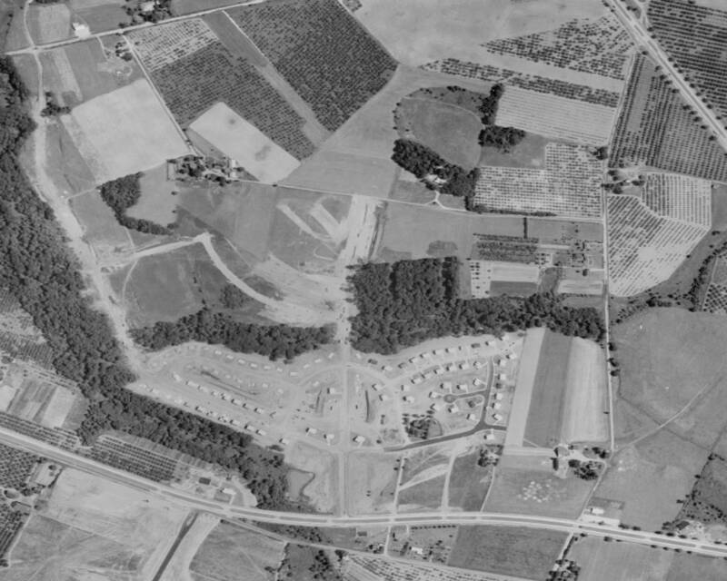
1963 Aerial Photograph - Woodstream
In this aerial view from 1963 we can see the first sections of Woodstream being built. The section to the right of Connestoga Drive, which runs up the center of the photo, appears to be just about complete while the section to the left of Connestoga is about half completed. The smaller white squares are the homes under construction.
The first sections of Hamilton and Woodbridge Roads are just being cleared and the woods are being cut through for Tinder Box and Teal Lane.
Since 05-10-2008
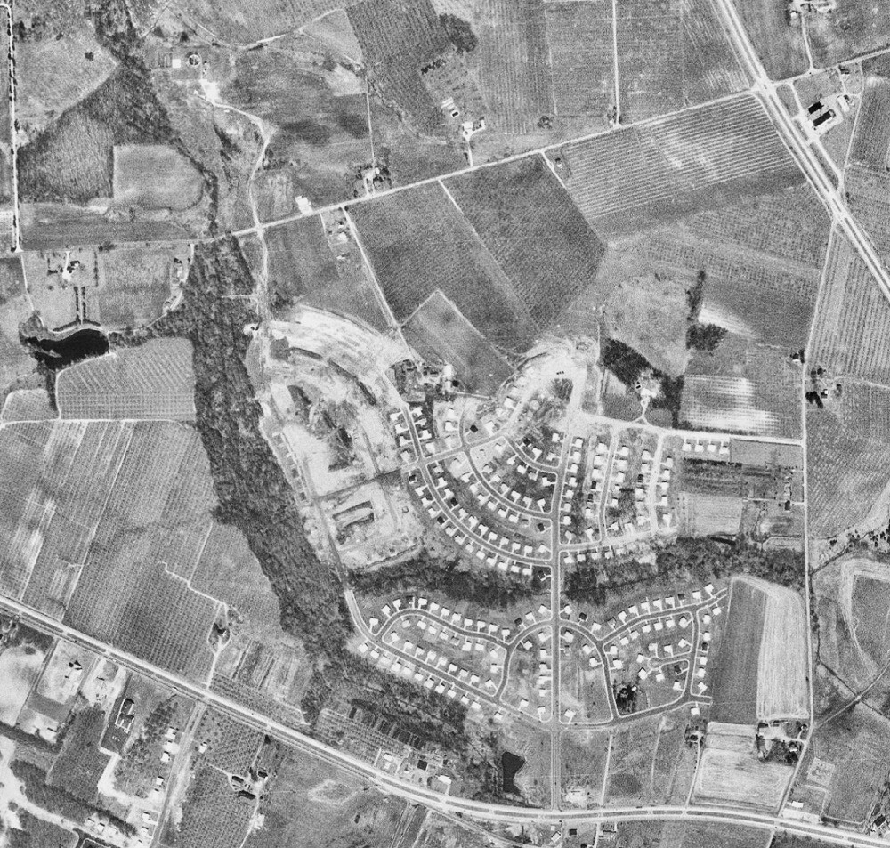
1965 Aerial Photograph - Woodstream
This aerial photo taken during the Spring of 1965 shows the progress of construction at Woodstream at that time. We can see that Woodstream was just about half way completed here. Constructuion extends to just north of Woodbridge Road, Carriage Lane and Revere Road. The Vennel farm at Hamilton Hill had recently lost its driveway to Cropwell Road, we can see only a portion of it left extending to where the homes along the upper portion of Woodbridge are being completed. The foundation for the A&P at Cropwell and Route 70 is shown along with the Shell gas station at Connestoga Drive and Route 70 nearing completion.