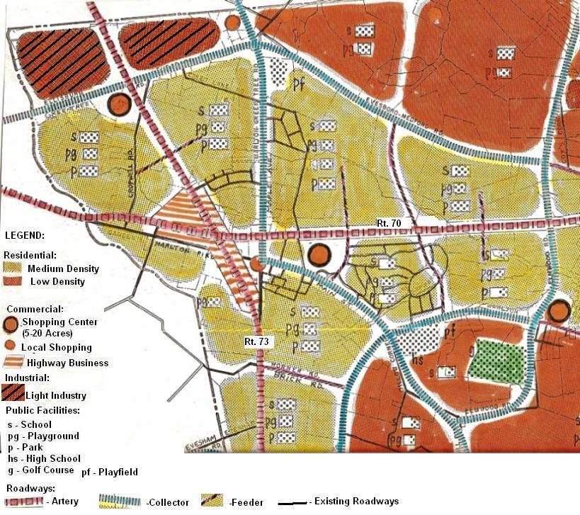
This March, 1959 map, drawn by Jack M. Kendree a Planning Consutant from Phila., was a glimpse into the future at the time. Interesting how much of this planning map became reality. Most of the shopping centers were built as shown (although there are more of them today than shown here), the shopping center at Route 73 and Greentree is shown across Route 73 from where it was actually built. The area north of Grentree Road was planned to be industry, today only the portion east of Route 73 is industry. The High School was shown to be built at Main Street and Willow Bend Road, not too far from where Cherokee High School was built.
Since 07-02-2008